On trips to the central Oregon Coast, Hideko and I drive to Monroe, then turn left a short distance north of town onto a side road leading to a lightly-traveled back road up the western slope of the Coast Range to Alsea Falls Recreation Site along the South Fork of the Alsea River.
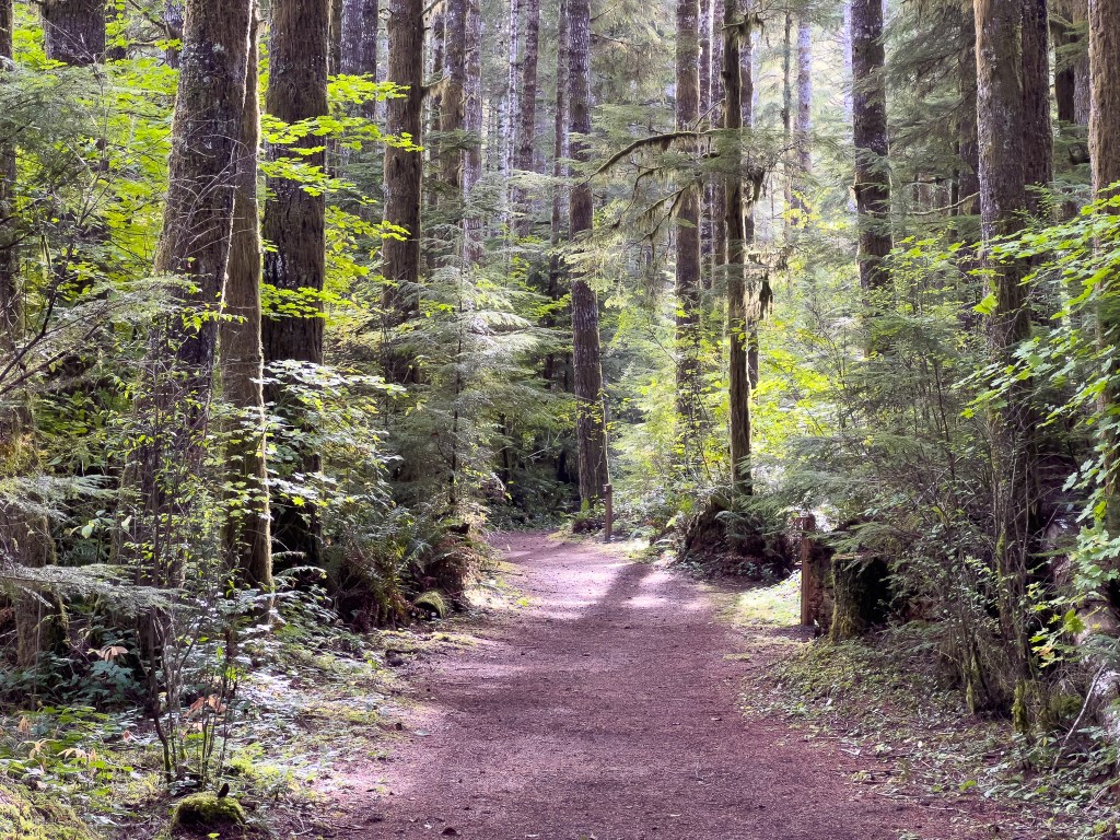
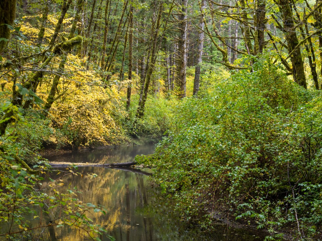
We park at the day-use area, hike the half-mile trail to the campground, cross the pedestrian bridge, and return on the river’s north bank to the falls area. The trail is quiet and immerses one in the natural sounds and aromas of the forest of red alders, western hemlock, western redcedar, vine maple, and wildflowers including Calypso orchids (Calypso bulbosa).
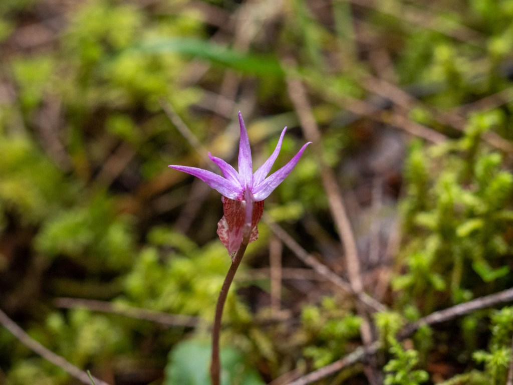
Get down to their level to see and smell them; use a magnifying glass if you like; just don’t pick them. Their bulblike corm is so shallowly planted that it’s almost impossible to pick them without ripping the corm’s lifeline. A calpyso is dependent on its fungal and plant hosts; its single leaf withers and is gone early in the growing season.
Natural History of the Pacific Northwest Mountains, Daniel Mathews, p. 182.
The spring and early summer birdsong is special: In June this year, we heard Swanison’s Thrush, Pacific-slope Flycatcher (now “reconstrued” as Western Flycatcher), Black-headed Grosbeak, Wilson’s Warbler, Hammond’s Flycatcher, Warbling Vireo, Pacific Wren, and Western Tanager.
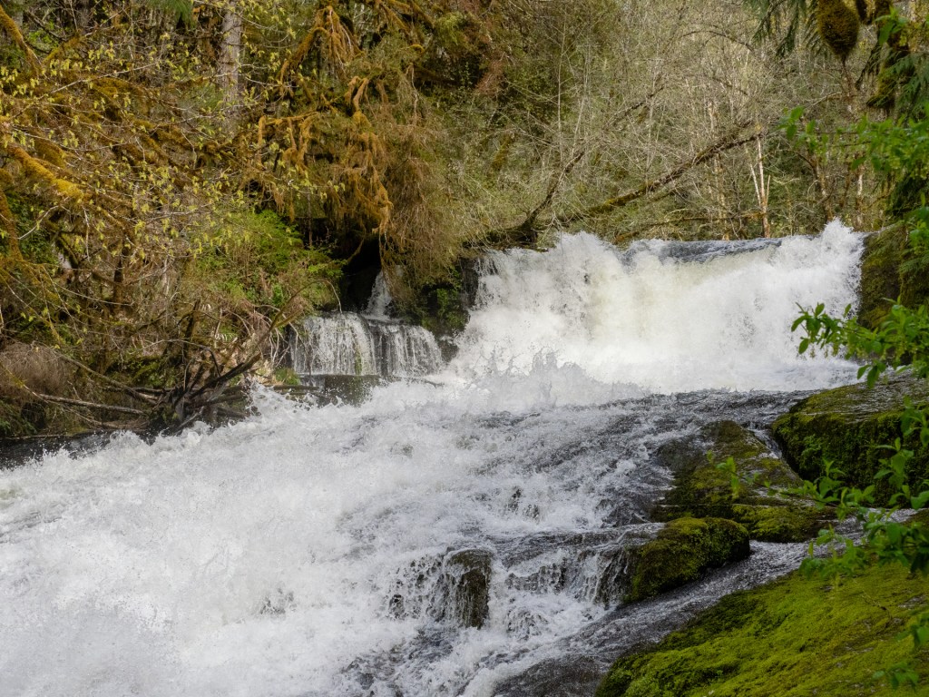
This summer, I captured video clips with my iPhone in July, August, and September and assembled a two-and-a-half-minute video of the forest path. The clip of the falls was filmed in September when the water level was low, but the natural beauty of the scene came through.
In the spring, the South Fork of the Alsea River has a strong water flow over the falls, as we saw in April 2022.
Click here to see a map of the Alsea Falls area.
The South Fork of the Alsea River joins the North Fork near the small town of Alsea, about 10 miles from Alsea Falls, and flows into the Pacific Ocean at Waldport, about 40 miles west. The North Fork begins on the slopes of Mary’s Peak, the tallest point in the Coast Range.

3 responses to “South Fork Alsea River”
What a gem of a place, Tom, with such a rich abundance of undisturbed natural life. Thank you for sharing about it. I get vicarious enjoyment from the adventures of you and Hideko. -Judith
>
LikeLiked by 1 person
Thank you, Judith! Yes, the Alsea Falls area is a great place to visit any time of year. My favorite is May or June, when birds sing in the forest.
LikeLike
This reminds me of West Virginia where I grew up. Almost Heaven.
LikeLike