Introduction
My last trip to northeast Oregon was in October 2012, and I had fond memories of this unique landscape. This fall, I wanted to see the yellow aspen leaves, so I decided it was time to visit Wallowa Lake again. I watched the wildfire season with concern, especially when I read that I-84 between Pendleton and Ontario was closed in July due to severe wildfires.
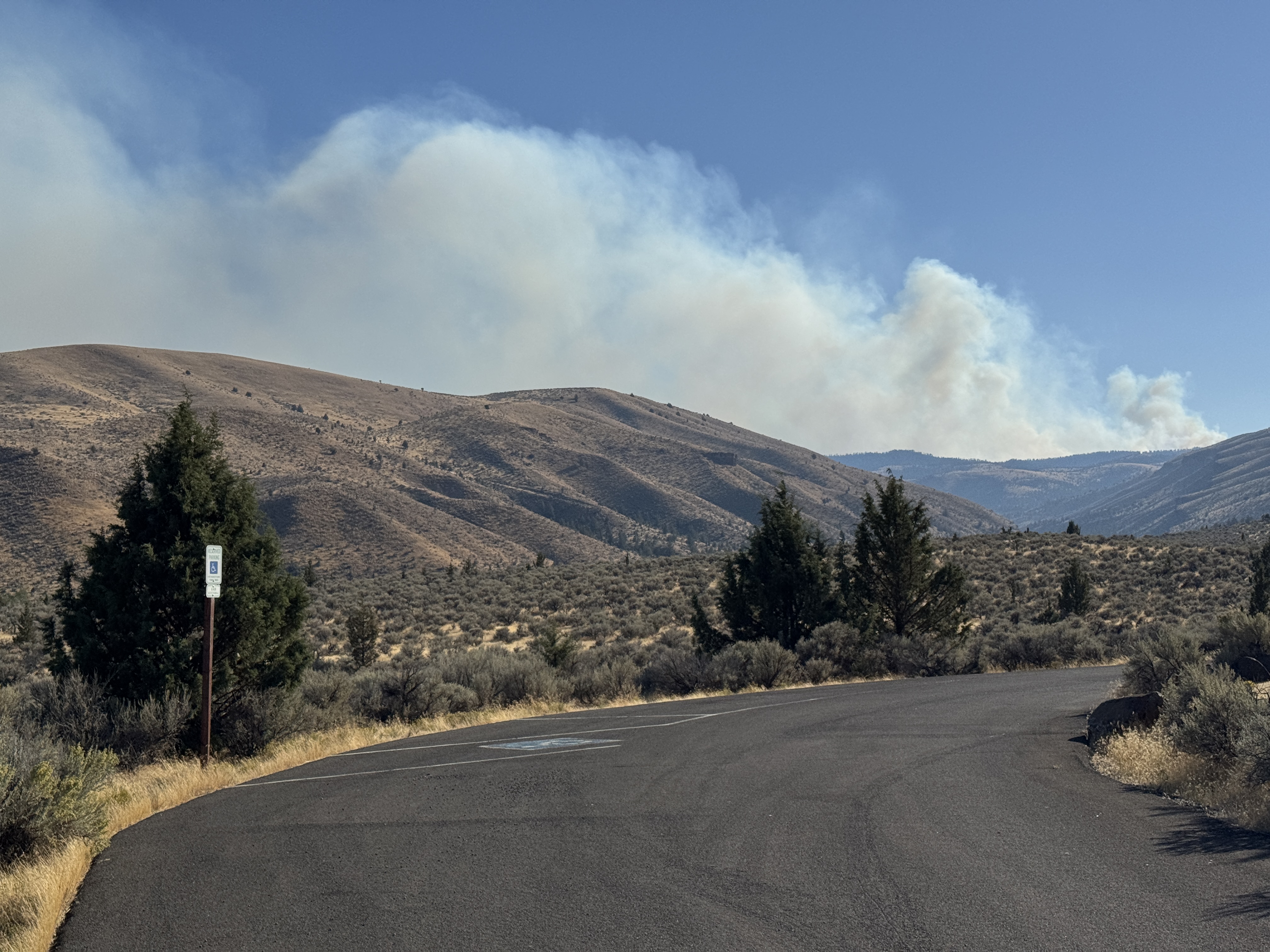
We made reservations for the second week in October, assuming the fire season would end by then. So, you can imagine our surprise and disappointment at seeing smoke drifting up from the other side of a ridge near Dayville on October 6. This may have been smoke from the large Rail Ridge Fire, mostly contained but still smoldering.
We saw no more wildfires, and the air was relatively clear as we drove further into northeast Oregon, although the weather remained warm and dry.
I mistakenly recalled that October was usually a rainy month, but in looking at weather records for the town of Enterprise, I see that November is historically wetter.1
My casual discussion with a guy wearing shorts and flip-flops while working at a sporting goods store in Joseph made this point clearer in a more practical way.
The end of the 2024 fire season in northeast Oregon was finally declared on October 22.2
Sumpter Valley Railway
The Blue Mountains are a prominent feature in Northeast Oregon. They encompass the uplands between the John Day River and the Snake River, or, to use city names as reference points, Clarno, Oregon, and Clarkston, Washington.
The Blue Mountains Province displays some of Oregon’s most diverse scenery and geology, traversed by uncrowded, sometimes lonely highways. In addition to the Blue Mountains, the region also encompasses the Ochoco, Strawberry, and Wallowa Mountains, which sustain snowfields throughout the year. Many peaks within these ranges exceed 8,000 feet (2,400 m).3
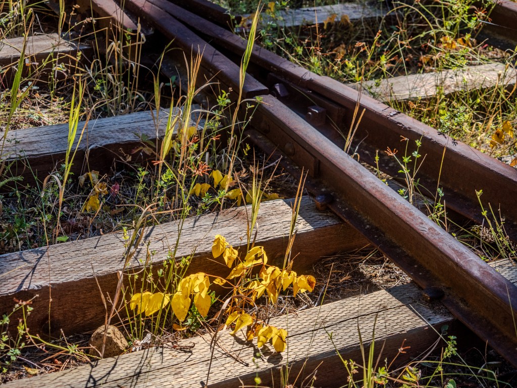
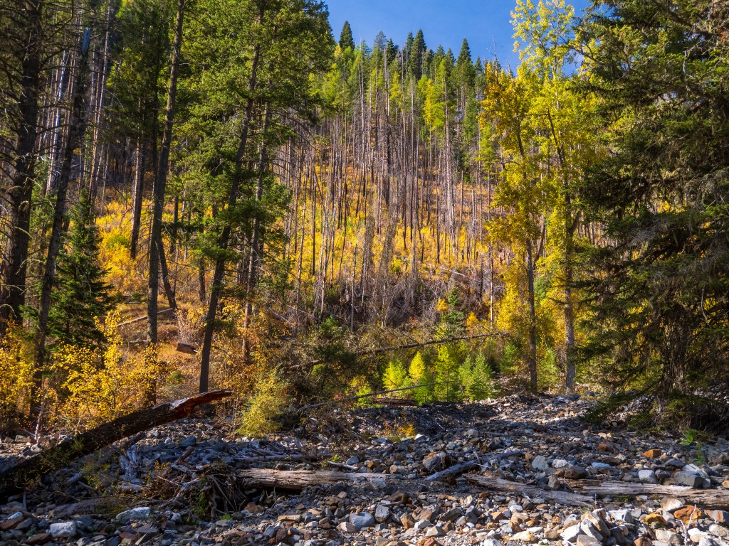
Our route from Bend crossed the Ochoco Mountains after leaving Prineville. The next day, we drove from John Day to Prairie City, which has expansive views of the Strawberry Mountains. A few miles beyond Prairie City, we stopped to walk a nature trail along the tracks of the historic Sumpter Valley Railway. This railway used to carry logs between Prairie City and Baker City until 1933.4
As we walked the trail through the forest, we came to a section of the railway with plantlife growing up between the ties, lit from behind by the low-angled October sun.
The trail overlooks the historic Dixie switchbacks that were used and abandoned by the Sumpter Valley Railway. The switchbacks were built to maintain acceptable grades into the John Day Valley. At 5,277 feet, it was the highest point on the original Sumpter Valley Railway mainline.5
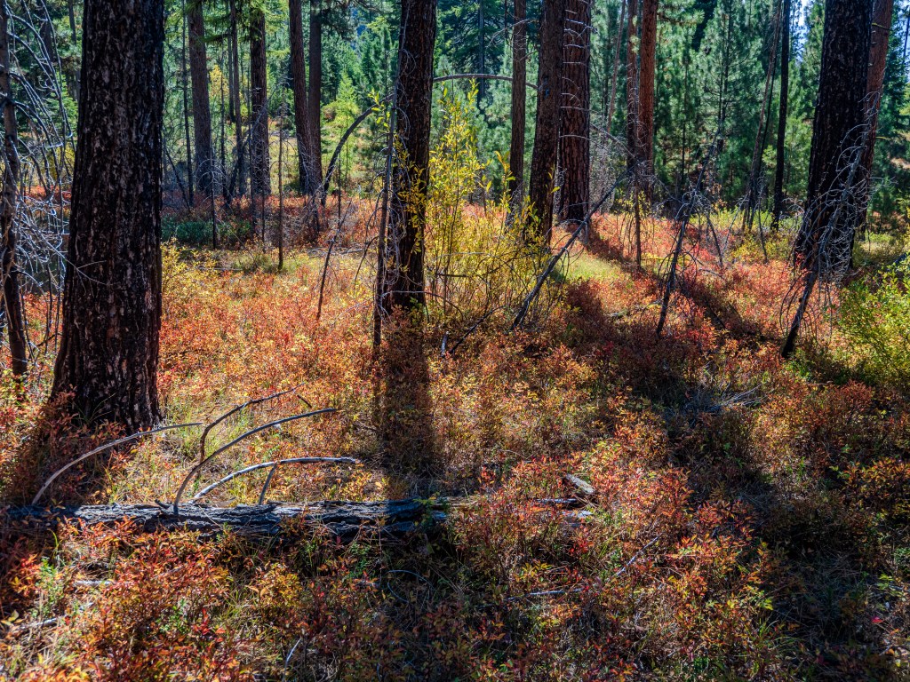
The backlit yellows of the aspen and larch trees drew our eyes. On prior trips, I attempted to capture photos at this location but felt frustrated by the chaos of tree trunks, harsh light, and shadows. This time, it felt easier to find a composition to work with.
At the end of our hike, I asked a Forest Service employee if she knew what the orange-red ground cover was. She said she thought they were huckleberry plants and added that the berries were delicious in July and August this year.
Powder River

Oregon Hwy 7 follows the Powder River on the east side of the Blue Mountains. We stopped to walk along the shore at the Powder River Recreation Site and found the fall colors lining both sides of the river enthralling.6
I was surprised I didn’t remember the Powder River from our 2012 trip, but I am happy to have ‘discovered’ it this time.
Impressions of Wallowa Lake

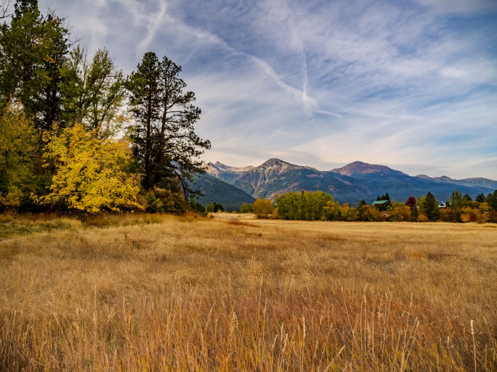
The route from Baker City to Wallowa Lake passes through La Grande, then Oregon Hwy 82 winds through the small communities of Elgin, Minam, Wallowa, and Lostine before arriving at Enterprise and then Joseph.
We have stayed near Wallowa Lake before, but this was the first time we had a direct view of the lake. The lodging options in the area include camping at Wallowa Lake State Park, cabins, hotels, and vacation rental homes.
The mid-morning sun cast warm light on the ponderosa pine trees along the shore, attracting my attention and bringing me outside to take a closer look with my camera.
We saw a variety of waterfowl on the lake, including Loons, Horned Grebes, Common Mergansers, Canada Geese, and Western Grebes. Steller’s Jays, Clark’s Nutcrackers, Northern Flickers, Red-breasted and Pygmy Nuthatches occupied the trees on shore.
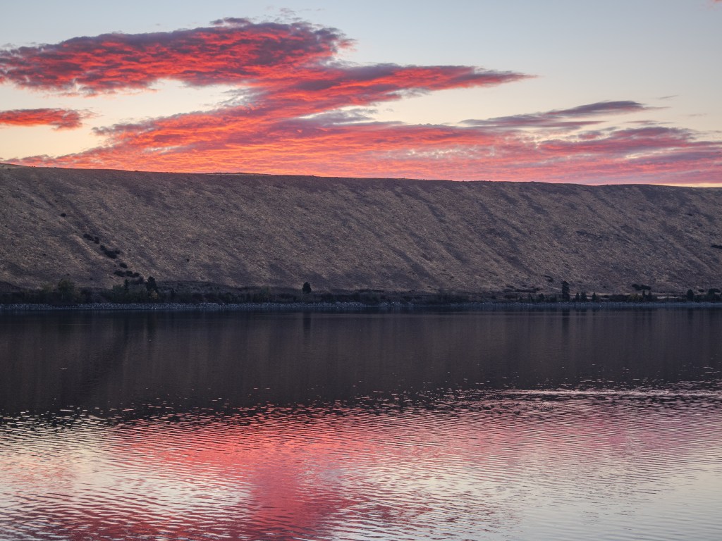
I watched the sunrise each morning during our stay, thinking about how to capture a photo of the scene. On the first morning, the colors developed directly to the east, and as I stood on the deck in the crisp air, I heard the unmistakable call of a Loon through the silence.
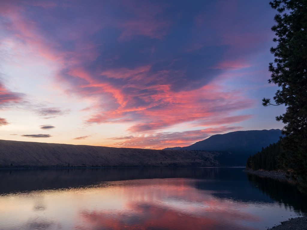
Before the sun rose above the East Moraine on our last day at Wallowa Lake, it illuminated the clouds with rich colors to the southeast, which brought the silhouette of the Wallowa Mountains into view. I rushed outside to record the fleeting scene.
Wallowa Lake Natural History
Wallowa Lake is ribbon-shaped, over three miles long, and located just south of Joseph. The lake “was dammed by a moraine…from a Pleistocene glacier that flowed out of the Wallowa Mountains.”7
Wallowa Lake was covered by a glacier 17,000 years ago, according to geologist Ellen Morris-Bishop, who further describes the significance of the lake below.
Wallowa Lake and its moraines track glacial advances and retreats over as much as 300,000 years. The inner, youngest moraines tower almost 900 feet above the lake surface. No other alpine moraine system in North America is as well exposed, accessible, or offers as complete a record.8

Ironically, in modern times, the East Moraine was privately-held land until four years ago, which prevented legal access to hikers. The people of Joseph collaborated through a fundraising campaign to preserve East Moraine from private development. They bought out the owner and established a community forest in 2020.
We hiked part of the East Moraine Trail on October 8, which provides views of Wallowa Lake through ponderosa pine trees. We walked cautiously by cattle grazing on the moraine, a practice in place for over one hundred years.9
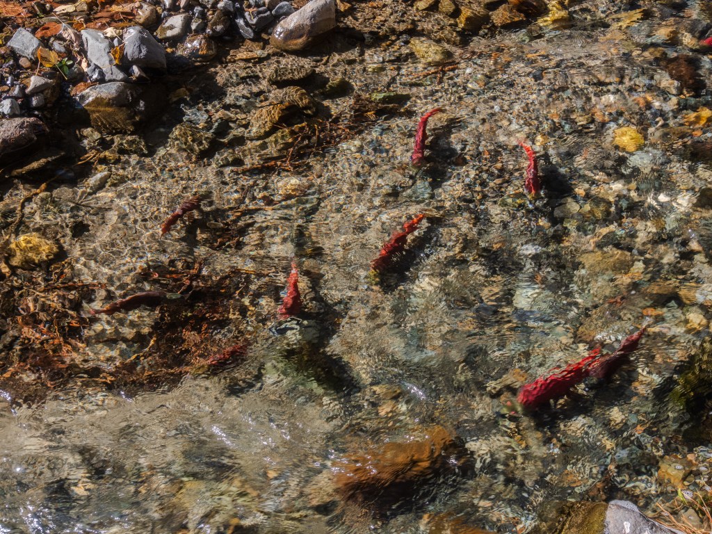
While picnicking at Wallowa Lake State Park, we noticed signs along the riverbank cautioning people not to disturb the spawning Kokanee Salmon. Intrigued, we walked carefully to the river to look for the fish. Considering their daunting challenges, we were encouraged to see fish spawning in the wild.
These Kokanee salmon live in freshwater and spawn in the Wallowa River upstream from Wallowa Lake. Historically, the salmon runs were extensive and were a vital food source for the Nez Perce people. In 1919, diversion dams for irrigation and flood control were built at Wallowa Lake, seriously disrupting salmon runs.
The Wallowa River project, led by the Nez Perce, has received Federal funds to update diversion dams to help restore the salmon runs in the Wallowa River. The project is currently scheduled for construction in 2024 and 2025.10 11 12
Zumwalt Prairie
Zumwalt Prairie occupies “500 square miles of Wallowa County” and is located a few miles north of Joseph along a rough gravel road. The Nature Conservancy owns and manages a 51-square-mile portion known as the Zumwalt Prairie Preserve.13
Wedged between Hells Canyon and the Wallowa Mountains, Zumwalt Prairie forms an island of gently rolling private grasslands surrounded by public lands. It’s also an ecological rarity: the last, best remnant of a bunchgrass prairie ecosystem distinctive to this region where Oregon, Washington and Idaho meet. While most of it was converted to agriculture elsewhere, here a combination of higher elevations, rougher climate and less-fertile soils made the prairie more suitable for seasonal grazing, which has left it much more intact.14
Journalist Roddy Sheer notes the importance of The Nature Conservancy’s role at Zumwalt Prairie.
The Nature Conservancy’s ownership of the heart of the Zumwalt prairie means continuing conservation and stewardship of this unique ecosystem and its native biodiversity. Just as important, it means research is being conducted here that will help biologists and land managers elsewhere prepare for changes wrought by non-native species, human development, and climate change, among other threats.15
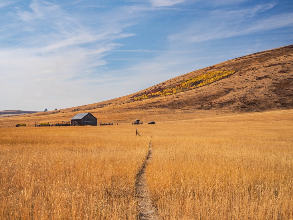
We hiked one of the narrow trails cut through the prairie leading from Duckett’s Barn, pictured above, occasionally climbing short ladders over barbwire fences. This remote location imparts a sense of spaciousness where the natural sounds of wind and birdsong are undisturbed by motor vehicles.
Hurricane Creek
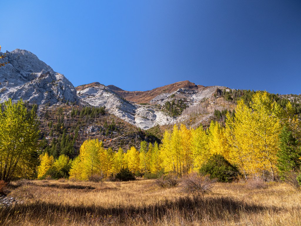
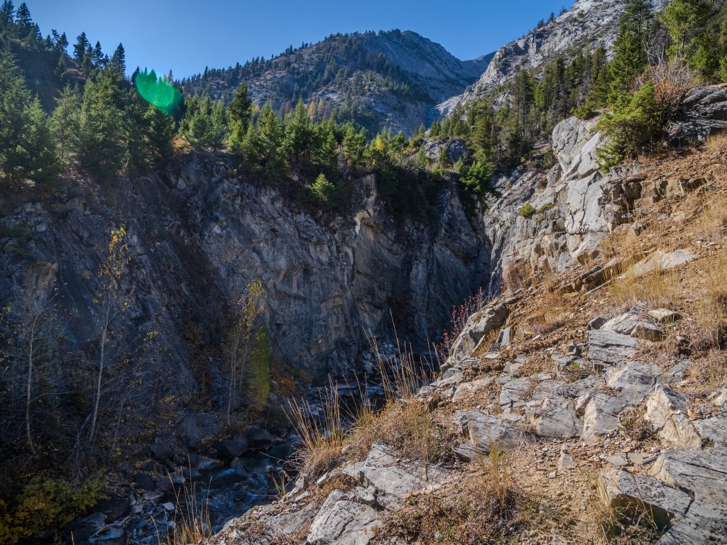
The stark contrast between the vast open space of Zumwalt prairie southwest and the narrow rocky canyon of Hurricane Creek, 31 miles southwest, is evident. The Hurricane Creek trail leads into the Eagle Cap Wilderness Area of the Wallowa Mountains. On a beautiful October day, we hiked 3 miles up this trail, admiring the yellow Aspen leaves and Hurricane Ridge’s dramatic limestone, marble, and basalt rock formations.
There were so many colorful vistas along the trail that I struggled to decide when to step off for photos. The decision to stop for the above view of Hurricane Ridge was simple.
The trail crossed several rocky dry creeks, like the one in the photo above, running down from the steep side of Hurricane Ridge.
One pair of hikers from the east coast asked if we were birders, and shared their amazement at hearing the songs of the abundant Townsends Solitaires.
We met several other people on the trail, including an enthusiastic solo hiker on a ten-mile route to capture photos of the Northern Lights and a group of adults and children with four llamas carrying loads.
After three miles, we came to a deep gully where the trail angled sharply up a precipitous cliff, and we all decided this was a good place to turn around.
This six-mile round-trip hike at over 5,000 feet of elevation left me feeling a sense of well-being and deep relaxation. We ended the outing with a late picnic lunch beside Hurricane Creek, listening to the songs of unseen American Dippers rising above the rushing water.
Iwetemlaykin State Heritage Site
The Iwetemlaykin State Heritage Site is located on the northeast corner of Wallowa Lake and is the sacred land of the Nez Perce people, the original inhabitants. We walked the trails as I pondered this beautiful location’s historical and cultural significance.
Before the coming of the white man, Native Americans inhabited the canyons and prairies of this remote section of northeast Oregon for more than ten thousand years. They became known, in modern times, as the Nez Perce tribe, whose lands spread into southeastern Washington, northeastern Oregon, and central Idaho. The Wallowa band of the Nez Perce lived in the beautiful Wallowa Valley and on the Zumwalt Prairie; their history is one of the saddest chapters in the opening up of the west.16
Conclusion
Northeast Oregon is an out-of-the-way part of Oregon. Visiting wilderness areas and nature preserves means sometimes going without conveniences such as cell phone coverage and restrooms. It also means ensuring your vehicle has a full tank of gas and sturdy tires.
Having been to Wallowa Lake twice in October, I can confidently say it is an excellent time to see fall colors and enjoy warm, dry days.
This road trip piqued my interest in learning more about the Wallowa and Blue Mountains. I am re-reading Marcy Houle’s The Prairie Keepers: Secrets of the Grasslands and am continuing to explore Robert Carson’s The Blues: Natural History of the Blue Mountains of Northeastern Oregon and Southeastern Washington. I hope that on our next trip to Wallowa Lake, I will understand more of the natural history of this unique part of Oregon.
Please comment below if you have suggestions for places to see in northeast Oregon or recommended reading.
- https://www.usclimatedata.com/climate/enterprise/oregon/united-states/usor0470 ↩︎
- https://elkhornmediagroup.com/northeast-oregon-department-of-forestry-declares-an-end-to-fire-season-2/ ↩︎
- Roadside Geology of Oregon, Second Edition, Marli B. Miller, p. 260. ↩︎
- Wikipedia https://en.wikipedia.org/wiki/Sumpter_Valley_Railway ↩︎
- US Forest Service https://www.fs.usda.gov/recarea/malheur/recarea/?recid=40170 ↩︎
- Wikipedia https://en.wikipedia.org/wiki/Powder_River_(Oregon) ↩︎
- Roadside Geology of Oregon, Marli B. Miller, p. 260. ↩︎
- Living with Thunder: Exploring the Geologic Past, Present, and Future of the Pacific Northwest, Ellen Morris Bishop, p. 117. ↩︎
- https://wallowalandtrust.org/index.php/what-we-do/properties-protected/east-moraine-community-forest ↩︎
- https://flyfisherscluboregon.com/welcome-back-sockeye-salmon-100-years-is-far-too-long/ ↩︎
- https://www.ijpr.org/environment-energy-and-transportation/2024-05-25/nearly-2-million-in-federal-money-headed-to-oregon-for-dam-removal-fish-restoration ↩︎
- https://www.oregon.gov/biz/Publications/Boards/IFA/2022/December/Presentation_Wallowa_Lake_120122.pdf ↩︎
- https://www.nature.org/en-us/magazine/magazine-articles/conservation-cowboys/ ↩︎
- https://www.nature.org/en-us/magazine/magazine-articles/conservation-cowboys/ ↩︎
- Oregon & Washington’s Roadside Ecology: 33 Easy Walks Through the Regionl’s Amazing Natural Areas, Roddy Sheer, p. 144. ↩︎
- The Prairie Keepers, Marcy Houle, p. 77. ↩︎

2 responses to “Northeast Oregon in October”
Oddly, my favorite was the most unrepresentative of the photos – the abandoned rail line. The pictures remind me of my home state of West Virginia.
LikeLiked by 1 person
Wh
LikeLike